Updated 15 November 2026
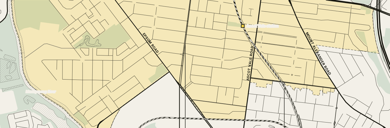
Inner north-west · City of Moonee Valley
Ascot Vale 3032
Ascot Vale Melbourne is an inner suburb about 7 km north-west of the CBD and part of the City of Moonee Valley. Four tram routes pass through Ascot Vale, and its station sits inside the suburb. Union Road is the local high street.
About Ascot Vale
The Flemington Farmers Market sets up on Sundays in the grounds of Ascot Vale Primary School, on Moonee Street. A council leisure centre on Epsom Road has a gym and pools. By the river, a council golf and sports centre on Newsom Street has a golf range and tennis courts. A self-guided walk with a printed trail guide starts at Union Road and Maribyrnong Road.
At a glance
- Area
- 3.84 km²
- State electorate
- Essendon
- Federal electorate
- Maribyrnong
Getting to the CBD
The 57 tram · Epsom Rd/Maribyrnong Rd stop → Flinders Street Station/Elizabeth St
40 min to Flinders Street Station/Elizabeth St on the 10:03 weekday tramThe Epsom Rd/Maribyrnong Rd stop is 750 m from the middle of Ascot Vale
Trip notes and all 31 stops
Ascot Vale station sits inside the suburb, and Flemington Racecourse station is the closest to its middle. The 57 tram runs along Maribyrnong Road and Union Road towards the CBD, and the 58, 59 and 82 also stop in Ascot Vale.
Epsom Rd/Maribyrnong Rd Start · Bowen St/Maribyrnong Rd 1 min · Hotham St/Maribyrnong Rd 1 min · Union Rd/Maribyrnong Rd 2 min · St Leonards Rd/Union Rd 3 min · Bloomfield Rd/Union Rd 3 min · Melbourne Showgrounds/Union Rd 5 min · Sandown Rd/Epsom Rd 6 min · Flemington Racecourse/Epsom Rd 7 min · Smithfield Rd/Racecourse Rd 9 min · Newmarket Plaza/Racecourse Rd 10 min · Wellington St/Racecourse Rd 11 min · Victoria St/Racecourse Rd 12 min · Stubbs St/Racecourse Rd 14 min · Boundary Rd/Racecourse Rd 15 min · Melrose St/Flemington Rd 16 min · Abbotsford St Interchange/Abbotsford St 18 min · Haines St/Abbotsford St 20 min · Arden St/Abbotsford St 21 min · Queensberry St/Abbotsford St 22 min · Curzon St/Queensberry St 23 min · North Melbourne Town Hall/Queensberry St 23 min · Victoria St/Errol St 24 min · Chetwynd St/Victoria St 26 min · Howard St/Victoria St 26 min · Peel St/Victoria St 28 min · Queen Victoria Market/Elizabeth St 30 min · Melbourne Central Station/Elizabeth St 33 min · Bourke Street Mall/Elizabeth St 37 min · Collins St/Elizabeth St 38 min · Flinders Street Station/Elizabeth St 40 min
PTV timetable data, retrieved 4 November 2026 · scheduled times; the walk to the stop is extra.
01 People
The median age was 37 in 2021, and couples without children formed over a third of families. Just over four in ten had moved in within five years. More than a quarter were born overseas.
- People
- 15,197
- Median age
- 37
- Born overseas
- 28%
- Language other than English at home
- 25%
- People per household
- 2.4
- Moved in within five years
- 42%
Show country, language and religion
Australian Bureau of Statistics, 2021 Census, Ascot Vale (suburb), retrieved 4 November 2026. Percentages are rounded; the bars show the largest groups only.
02 Schools
Ascot Vale has four schools inside the suburb and six more close by. Most families start with the government school their street is zoned for, then look at Catholic and independent schools nearby.
Zones that cover most of Ascot Vale
Share of the suburb inside each 2027 government school zone.
Primary school zones
These zones cover nearly the whole suburb.
Year 7 zones
These zones cover nearly the whole suburb.
All 10 schools in and near Ascot Vale
Primary schools
5 schoolsSecondary schools
3 schoolsPrimary and secondary
1 schoolSpecialist school
1 schoolNo schools match this filter.
Sources: Victorian Department of Education, school locations and enrolments, retrieved 3 November 2026. © State of Victoria (Department of Education), CC BY 4.0; Victorian Government School Zones 2027, share of the suburb's area inside each zone (zones under 5% left out), retrieved 9 November 2026. Student numbers are rounded.
03 Parks
Fairbairn Park is the biggest green space close by. The Maribyrnong River and Victory Park are a short walk from the middle of Ascot Vale, by Walter Street Reserve.
- Walter Street ReservePublic open space300 m
- Fairbairn ParkPublic open space550 m
- MARIBYRNONG RIVERPublic open space700 m
- Victory ParkPublic open space750 m
Show all 6 parks
- Moonee Ponds Creek Frontage - Moonee ValleyPublic open space2.8 km
- Essendon Hockey CentrePublic open space2.8 km
Park names and places: © OpenStreetMap contributors, retrieved 15 November 2026. Nearest first, measured in a straight line from the middle of Ascot Vale.
04 Shops and cafés
Union Road is the main shopping street, with cafés, two bakeries, two pharmacies, a butcher and a sports shop. Many of its shopfronts date from about 1885 to 1930. More cafés sit on Mount Alexander Road and Maribyrnong Road, handy for brekkie.
Cafés, food and takeaway 7
Little Byrd
Café160 Union Road, Ascot Vale VIC 3032WebsiteNo. 19
Café214 Union Road, Ascot Vale VIC 3032WebsiteLove Latte
Café212 Union Road, Ascot Vale VIC 3032WebsiteOld Man Drew
Café361 Mount Alexander Road, Ascot Vale VIC 3032WebsiteMiddle Child
Café327 Maribyrnong Road, Ascot Vale VIC 3032Mister Nice Guy's Bakeshop
Bakery151 Union Road, Ascot Vale VIC 3032Routley's Bakery
Bakery220 Union Road, Ascot Vale VIC 3032Website
Show shops and services (6)
Shops and services 6
Union Road Pharmacy
Pharmacy191 Union Road, Ascot Vale VIC 3032WebsiteAscot Vale Pharmacy
Pharmacy67-69 Union Road, Ascot Vale VIC 3032WebsiteAscot Vale Meat and Poultry
Butcher193 Union Road, Ascot Vale VIC 3032Ascot Vale Library
Library165 Union Road, Ascot Vale VIC 3032WebsiteWingate Avenue Community Centre
Community centre13A Wingate Avenue, Ascot Vale VIC 3032WebsiteAscot Vale Sports & Trophies
Sports shop1-5 Union Road, Ascot Vale VIC 3032Website
Listings checked 15 November 2026. Run a business here? Tell us
05 Things to do in Ascot Vale
Ascot Vale Leisure Centre
Leisure centre · Epsom Road and Langs Road, Ascot Vale VIC 3032
A council leisure centre with a gym and indoor pools.
Ascot Vale Leisure Centre website, checked 15 November 2026
Riverside Golf and Sports Centre
Golf and sports centre · 75 Newsom Street, Ascot Vale VIC 3032
A council golf and sports centre on the Maribyrnong River with a nine-hole golf range and tennis and netball courts.
Riverside Golf and Sports Centre website, checked 15 November 2026
Show all 5 things to do
Flemington Farmers Market
Farmers market · Ascot Vale Primary School, Moonee Street, Ascot Vale VIC 3032
A farmers market held on Sundays in the grounds of Ascot Vale Primary School.
Flemington Farmers Market website, checked 15 November 2026
Ascot Vale Walking Trail
Heritage walking trail · Starts at Union Road and Maribyrnong Road, Ascot Vale VIC 3032
A 2 km self-guided heritage walk around Union Road and the Temperance Township Triangle, with a printed trail guide.
Ascot Vale Walking Trail website, checked 15 November 2026
Union Road heritage shopping strip
Heritage shopping strip · 169-239 and 230-250 Union Road, Ascot Vale VIC 3032
A strip of shops built from about 1885 to 1930, with the Union Hotel and the former New Ascot Cinema among its heritage buildings.
Union Road heritage shopping strip website, checked 15 November 2026
06 Distances
 StationFlemington Racecourse station1.2 km
 UniversityVictoria University, Footscray Park1.6 km
 ShopsHighpoint1.6 km
 HospitalFootscray Hospital2.3 km
 BeachWilliamstown beach10.2 km
 AirportMelbourne Airport12.7 km
| Place | Distance |
|---|---|
| 1.2 km | |
| 1.6 km | |
| 1.6 km | |
| 2.3 km | |
| 7.1 km | |
| 10.2 km | |
| 12.7 km |
The street map loads here. If it has not appeared, your network blocks the map tiles; every figure on this page stands without it.
Measured in a straight line from the middle of Ascot Vale, near Walter Street Reserve.
Nearby suburbs
All Melbourne suburbs →7 suburbs share a boundary with Ascot Vale, from the ABS suburb boundaries, retrieved 4 November 2026. Letters give the direction from Ascot Vale.
07 Questions about Ascot Vale
Where is Ascot Vale and how far is it from the CBD?
Ascot Vale sits north-west of the CBD in Melbourne's inner suburbs. The 57 tram trip from Epsom Road to Flinders Street takes about 40 minutes.
Which tram goes to the Melbourne Showgrounds?
The 57 tram stops at the Melbourne Showgrounds stop on Union Road in Ascot Vale, on its way to the CBD.
Which trains and trams serve Ascot Vale?
The suburb has its own station, Ascot Vale, with Flemington Racecourse, Moonee Ponds and Newmarket stations close by. The 57, 58, 59 and 82 trams all stop in Ascot Vale.
Which schools are in Ascot Vale?
Ascot Vale Primary School on Bank Street, Ascot Vale West Primary School on Langs Road and St Mary's School on Roseberry Street are all primary schools. Ascot Vale Heights School on Tasma Street is a specialist school.
Which council is Ascot Vale in?
The City of Moonee Valley looks after Ascot Vale. The suburb sits in the state seat of Essendon and the federal seat of Maribyrnong.
08 Sources
26 sources
- Australian Bureau of Statistics, Australian Statistical Geography Standard Edition 3CC BY 4.0 · retrieved 4 November 2026
- Australian Bureau of Statistics, Counts of Australian BusinessesCC BY 4.0 · retrieved 9 November 2026
- Australian Bureau of Statistics, 2021 Census of Population and HousingCC BY 4.0 · retrieved 4 November 2026
- Australian Bureau of Statistics, Postal Areas 2021 (ASGS Edition 3 allocation file)CC BY 4.0 · retrieved 4 November 2026
- Australian Bureau of Statistics, 2021 Census Working Population ProfileCC BY 4.0 · retrieved 9 November 2026
- Victorian Department of Education, Find My SchoolReference only · retrieved 3 November 2026
- OpenStreetMap contributors; OpenFreeMap tilesODbL · retrieved 15 November 2026
- Public Transport Victoria, GTFS scheduleCC BY 4.0 · retrieved 4 November 2026
- Victorian Department of Education, All Schools FTE Enrolments, February 2026CC BY 4.0 · retrieved 9 November 2026
- Victorian Department of Education, Victorian Government School Zones 2027CC BY 4.0 · retrieved 9 November 2026
- Victorian Department of Education, school locations (DataVic)CC BY 4.0 · retrieved 3 November 2026
- Vicmap, Department of Transport and PlanningCC BY 4.0 · retrieved 3 November 2026
- littlebyrd.com.au — Little Byrdretrieved 15 November 2026
- no19.com.au — No. 19retrieved 15 November 2026
- love-latte.jany.io — Love Latteretrieved 15 November 2026
- oldmandrewcafe.com.au — Old Man Drewretrieved 15 November 2026
- routleysbakery.com.au — Routley's Bakeryretrieved 15 November 2026
- unionroadpharmacy.com.au — Union Road Pharmacyretrieved 15 November 2026
- ascotvalepharmacy.com.au — Ascot Vale Pharmacyretrieved 15 November 2026
- Moonee Valley Libraries — Ascot Vale Libraryretrieved 15 November 2026
- ascotvalesports.com.au — Ascot Vale Sports & Trophiesretrieved 15 November 2026
- Seniors Online Victoria — Ascot Vale Leisure Centreretrieved 15 November 2026
- Moonee Valley City Council — Riverside Golf and Sports Centreretrieved 15 November 2026
- flemingtonfarmersmarket.com.au — Flemington Farmers Marketretrieved 15 November 2026
- Moonee Valley City Council — Ascot Vale Walking Trailretrieved 15 November 2026
- Victorian Heritage Database — Union Road heritage shopping stripretrieved 15 November 2026
This page is a guide, not advice. Check zones and timetables with the source before you decide anything. · Map © OpenStreetMap contributors