Updated 15 November 2026
Inner north and east · City of Yarra
Collingwood 3066
Collingwood Melbourne lies in the City of Yarra, about 2 km north-east of the CBD. Its main shopping strip runs along Smith Street. Collingwood station sits a few minutes' walk from the middle of the suburb. A Mernda line train takes about 8 minutes to reach Flinders Street.
About Collingwood
Collingwood Yards, a cultural precinct in the former Collingwood Technical School, sits on Johnston Street. Gertrude Glasshouse, a contemporary art gallery, is on Glasshouse Road, and Australian Galleries is on Derby Street. Flats make up about seven in ten of the homes.
At a glance
- Area
- 1.27 km²
- State electorate
- Richmond
- Federal electorate
- Melbourne
Getting to the CBD
Mernda line · Collingwood station → Flinders Street
8 min to Flinders Street on the 10:08 weekday trainCollingwood station is 550 m from the middle of Collingwood
Trip notes and all 5 stops
Collingwood station is on the Mernda line, a few minutes' walk from the middle of the suburb. The 86 tram has six stops in the suburb, and the 12 and 109 trams have three stops each.
Collingwood Start · North Richmond 2 min · West Richmond 3 min · Jolimont-MCG 5 min · Flinders Street 8 min
PTV timetable data, retrieved 4 November 2026 · scheduled times; the walk to the station is extra.
01 People
Collingwood's median age was 33 at the 2021 Census, and homes held fewer than two people on average. About two in three residents had arrived within the last five years.
- People
- 9,179
- Median age
- 33
- Born overseas
- 35%
- Language other than English at home
- 25%
- People per household
- 1.9
- Moved in within five years
- 65%
Show country, language and religion
Australian Bureau of Statistics, 2021 Census, Collingwood (suburb), retrieved 4 November 2026. Percentages are rounded; the bars show the largest groups only.
02 Schools
Collingwood has three schools inside the suburb and six more close by. Most families start with the government school their street is zoned for, then look at Catholic and independent schools nearby.
Zones that cover most of Collingwood
Share of the suburb inside each 2027 government school zone.
Primary school zones
These zones cover nearly the whole suburb.
Year 7 zones
This zone covers nearly the whole suburb.
All 9 schools in and near Collingwood
Primary schools
6 schoolsSecondary schools
1 schoolPrimary and secondary
1 schoolOther schools
1 schoolNo schools match this filter.
Sources: Victorian Department of Education, school locations and enrolments, retrieved 3 November 2026. © State of Victoria (Department of Education), CC BY 4.0; Victorian Government School Zones 2027, share of the suburb's area inside each zone (zones under 5% left out), retrieved 9 November 2026. Student numbers are rounded.
03 Parks
Peel Street Park, Otter Street Park and Oxford Street Park give the side streets some green. Cambridge Street Reserve and McNamara Reserve round out the list.
- Cambridge Street ReservePark or reserve
- McNamara ReservePark or reserve
- Otter Street ParkPark or reserve
- Oxford Street ParkPark or reserve
Show all 5 parks
- Peel Street ParkPark or reserve
Park names and places: yarracity.vic.gov.au, © OpenStreetMap contributors, retrieved 15 November 2026. Nearest first, measured in a straight line from the middle of Collingwood.
04 Shops and cafés
Smith Street holds a supermarket, a pharmacy and a bakery, along with a record shop and a violin shop. A hardware store sits on Cambridge Street, and cafés spread through side streets such as Peel Street and Easey Street, so brekkie is never far away.
Cafés, food and takeaway 9
Bottega Coffee
Café99 Johnston Street, Collingwood VICWebsiteJour Cafe and Store
Café29 Keele Street, Collingwood VICWebsiteAgeyo Coffee
Café25 Easey Street, Collingwood VICWebsitePlug Nickel
Café7 Peel Street, Collingwood VICWebsiteTwo Birds Cafe
Café29-31 Peel Street, Collingwood VICWebsiteNourish Collingwood
Café118 Smith Street, Collingwood VICWebsiteSouth of Johnston
Café46 Oxford Street, Collingwood VICWebsiteFalco Bakery
Bakery288 Smith Street, Collingwood VICWebsiteTo Be Frank Bakery
Bakery1/4 Bedford Street, Collingwood VICWebsite
Show shops and services (8)
Shops and services 8
Newton & Leung Pharmacy
Pharmacy272 Smith Street, Collingwood VICWebsiteColes Collingwood
Supermarket172 Smith Street, Collingwood VICWah Wah Records
Record shop196 Smith Street, Collingwood VICWebsitePasta Classica
Deli352 Smith Street, Collingwood VICWebsiteThe Source Bulk Foods Fitzroy
Grocer202 Smith Street, Collingwood VICWebsiteI-Care Optometrists
Optometrist110 Smith Street, Collingwood VICWebsiteAlex W Grant Violins
Musical instrument shop26 Smith Street, Collingwood VICWebsiteThe Hub General Store
Hardware store36 Cambridge Street, Collingwood VICWebsite
Listings checked 9 to 10 November 2026. Run a business here? Tell us
05 Things to do in Collingwood
Collingwood Yards
Arts precinct · 35 Johnston Street, Collingwood VIC 3066
A cultural precinct in the former Collingwood Technical School complex on Johnston Street.
Collingwood Yards website, checked 9 November 2026
The Tote
Music venue · 67 Johnston Street, Collingwood VIC 3066
A live-music hotel at 67 Johnston Street, in the building listed as the former Ivanhoe Hotel.
The Tote website, checked 9 November 2026
Show all 6 things to do
Gertrude Glasshouse
Gallery · 44 Glasshouse Road, Collingwood VIC 3066
A contemporary art gallery on Glasshouse Road.
Gertrude Glasshouse website, checked 10 November 2026
Australian Galleries
Gallery · 35 Derby Street, Collingwood VIC 3066
A commercial art gallery on Derby Street.
Australian Galleries website, checked 10 November 2026
Bendigo Hotel
Music venue · 125 Johnston Street, Collingwood VIC 3066
A live-music pub on Johnston Street, listed in the Victorian Heritage Database.
Bendigo Hotel website, checked 10 November 2026
Eclipse Cinema
Cinema · 32 Wellington Street, Collingwood VIC 3066
OpenStreetMap contributors, checked 10 November 2026
06 Distances
 ShopsSmith Street450 m
 StationCollingwood station550 m
 HospitalSt Vincent's Hospital1.2 km
 UniversityRMIT, city campus2.2 km
 BeachSt Kilda beach7.1 km
 AirportMelbourne Airport19.4 km
| Place | Distance |
|---|---|
| 450 m | |
| 550 m | |
| 1.2 km | |
| 2.2 km | |
| 2.4 km | |
| 7.1 km | |
| 19.4 km |
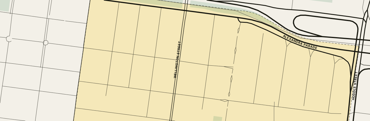
The street map loads here. If it has not appeared, your network blocks the map tiles; every figure on this page stands without it.
Measured in a straight line from the middle of Collingwood, near Cambridge Street Reserve.
Nearby suburbs
All Melbourne suburbs →6 suburbs share a boundary with Collingwood, from the ABS suburb boundaries, retrieved 4 November 2026. Letters give the direction from Collingwood.
07 Questions about Collingwood
Do the Smith Street shops sit in Collingwood?
Yes. The supermarket at 172, the record shop at 196 and the deli at 352 on Smith Street all have Collingwood addresses, and Fitzroy lies to the west of the suburb.
Where is Collingwood and how far from the CBD?
Collingwood is in the City of Yarra, just north-east of the CBD. A Mernda line train from Collingwood station reaches Flinders Street in about 8 minutes on a weekday.
Which train station is nearest to Collingwood?
Collingwood station, on the Mernda line, is the closest. You can walk there from the middle of Collingwood in a few minutes, and North Richmond and Victoria Park stations lie a little further away.
Which parks are in Collingwood?
Collingwood's named parks include Peel Street Park, Otter Street Park and Oxford Street Park. Cambridge Street Reserve and McNamara Reserve add more green space.
Which council is Collingwood in?
The City of Yarra covers all of Collingwood. The suburb sits in the state electorate of Richmond and the federal electorate of Melbourne.
08 Sources
36 sources
- Australian Bureau of Statistics, Australian Statistical Geography Standard Edition 3CC BY 4.0 · retrieved 4 November 2026
- Australian Bureau of Statistics, Counts of Australian BusinessesCC BY 4.0 · retrieved 9 November 2026
- Australian Bureau of Statistics, 2021 Census of Population and HousingCC BY 4.0 · retrieved 4 November 2026
- Australian Bureau of Statistics, Postal Areas 2021 (ASGS Edition 3 allocation file)CC BY 4.0 · retrieved 4 November 2026
- Australian Bureau of Statistics, 2021 Census Working Population ProfileCC BY 4.0 · retrieved 9 November 2026
- Victorian Department of Education, Find My SchoolReference only · retrieved 3 November 2026
- OpenStreetMap contributors; OpenFreeMap tilesODbL · retrieved 15 November 2026
- Public Transport Victoria, GTFS scheduleCC BY 4.0 · retrieved 4 November 2026
- Victorian Department of Education, All Schools FTE Enrolments, February 2026CC BY 4.0 · retrieved 9 November 2026
- Victorian Department of Education, Victorian Government School Zones 2027CC BY 4.0 · retrieved 9 November 2026
- Victorian Department of Education, school locations (DataVic)CC BY 4.0 · retrieved 3 November 2026
- Vicmap, Department of Transport and PlanningCC BY 4.0 · retrieved 3 November 2026
- Yarra City Council — Cambridge Street Reserve, McNamara Reserve and othersretrieved 9 November 2026
- bottegacoffee.com.au — Bottega Coffeeretrieved 9 November 2026
- jour.com.au — Jour Cafe and Storeretrieved 9 November 2026
- ageyocoffee.com.au — Ageyo Coffeeretrieved 9 November 2026
- plugnickel.com.au — Plug Nickelretrieved 9 November 2026
- twobirdscafe.com.au — Two Birds Caferetrieved 9 November 2026
- nourishcollingwood.com — Nourish Collingwoodretrieved 9 November 2026
- southofjohnston.com.au — South of Johnstonretrieved 9 November 2026
- falcobakery.com — Falco Bakeryretrieved 9 November 2026
- tobefrankbakery.com.au — To Be Frank Bakeryretrieved 9 November 2026
- newtonleungpharmacy.com.au — Newton & Leung Pharmacyretrieved 9 November 2026
- coles.com.au — Coles Collingwoodretrieved 9 November 2026
- wahwahrecords.com.au — Wah Wah Recordsretrieved 10 November 2026
- pastaclassica.com.au — Pasta Classicaretrieved 10 November 2026
- thesourcebulkfoods.com.au — The Source Bulk Foods Fitzroyretrieved 10 November 2026
- i-care.com.au — I-Care Optometristsretrieved 10 November 2026
- grantviolins.com.au — Alex W Grant Violinsretrieved 10 November 2026
- thehubgeneralstore.com.au — The Hub General Storeretrieved 10 November 2026
- Victorian Heritage Database — Collingwood Yardsretrieved 9 November 2026
- Victorian Heritage Database — The Toteretrieved 9 November 2026
- gertrude.org.au — Gertrude Glasshouseretrieved 10 November 2026
- australiangalleries.com.au — Australian Galleriesretrieved 10 November 2026
- Victorian Heritage Database — Bendigo Hotelretrieved 10 November 2026
- api.openstreetmap.org — Eclipse Cinemaretrieved 10 November 2026
This page is a guide, not advice. Check zones and timetables with the source before you decide anything. · Map © OpenStreetMap contributors