Updated 15 November 2026
West · City of Melton
Aintree 3336
Aintree VIC is a young suburb in the City of Melton, about 29 km north-west of the CBD. Life centres on Woodlea Town Centre, on Lim Way. Aintree has no station inside it, but Rockbank station on the Melton line is a short drive away.
About Aintree
Woodlea Town Centre holds a supermarket and most of the local shops, with a few more on Fields Street and Frontier Avenue. A children's and community centre sits on Timbertop Parade, and a swim school runs on Plains Circuit. Almost every home here is a house on its own block. Drivers join the Western Freeway at Leakes Road for the city or Ballarat.
At a glance
- Area
- 6.73 km²
- State electorate
- Kororoit
- Federal electorate
- Gorton
Getting to the CBD
Melton line · Rockbank station → Southern Cross
34 min to Southern Cross on the 10:17 weekday trainRockbank station is 2.0 km from Woodlea Town Centre
Trip notes and all 7 stops
The nearest station is Rockbank, a short drive away. A weekday Melton line train takes about 34 minutes from there to Southern Cross, stopping at Caroline Springs, Sunshine and Footscray on the way. Melbourne Airport is a freeway drive from Aintree.
Rockbank Start · Caroline Springs 6 min · Deer Park 10 min · Ardeer 13 min · Sunshine 18 min · Footscray 24 min · Southern Cross 34 min
PTV timetable data, retrieved 4 November 2026 · scheduled times; the walk to the station is extra.
01 People
Aintree is a young suburb, with a median age of 30 at the 2021 Census. Couples with children were about seven in ten of its families, and nearly everyone had moved in within the previous five years. Over half of residents were born overseas.
- People
- 7,982
- Median age
- 30
- Born overseas
- 52%
- Language other than English at home
- 65%
- People per household
- 3.6
- Moved in within five years
- 94%
Show country, language and religion
Australian Bureau of Statistics, 2021 Census, Aintree (suburb), retrieved 4 November 2026. Percentages are rounded; the bars show the largest groups only.
02 Schools
Aintree has three schools inside the suburb and five more close by. Most families start with the government school their street is zoned for, then look at Catholic and independent schools nearby.
Zones that cover most of Aintree
Share of the suburb inside each 2027 government school zone.
Primary school zones
These zones cover nearly the whole suburb.
Year 7 zones
This zone covers nearly the whole suburb.
All 8 schools in and near Aintree
Primary schools
5 schoolsSecondary schools
1 schoolSpecialist school
1 schoolOther schools
1 schoolNo schools match this filter.
Sources: Victorian Department of Education, school locations and enrolments, retrieved 3 November 2026. © State of Victoria (Department of Education), CC BY 4.0; Victorian Government School Zones 2027, share of the suburb's area inside each zone (zones under 5% left out), retrieved 9 November 2026. Student numbers are rounded.
03 Parks
Aintree Recreation Reserve sits very close to the middle of Aintree, and Bullion Park is a short walk away. Arbourton Park, Frontier Park and Lagoon Park are a little further out.
- Aintree Recreation ReservePark or reserve150 m
- Bullion ParkPark or reserve700 m
- Aintree Reserve ParkPark or reserve850 m
- Lagoon ParkPark or reserve900 m
Show all 12 parks
- Frontier ParkPark or reserve900 m
- Aintree Town Centre ReservePark or reserve950 m
- Stockade ReservePark or reserve1.0 km
- Arbourton ParkPark or reserve1.0 km
- Pioneer ParkPark or reserve1.4 km
- Featherwood ParkPark or reserve1.5 km
- Tussock ReservePark or reserve1.5 km
- Cascade ReservePark or reserve1.5 km
Park names and places: © OpenStreetMap contributors, retrieved 4 November 2026. OpenStreetMap maps 43 parks and 22 playgrounds for Aintree, named or not. Nearest first, measured in a straight line from Woodlea Town Centre.
04 Shops and cafés
Woodlea Town Centre holds a supermarket, an Indian grocer, a fruit and vegetable shop, a pharmacy and a newsagent. Two cafés, an Indian restaurant and pizza and burger takeaways sit there too, with a Malaysian restaurant at 1 Lim Way. Fields Street has another restaurant and a bottle shop (a liquor store), and Frontier Avenue a clothing shop.
Cafés, food and takeaway 7
Culpa Espresso
CaféWoodlea Town Centre, 2 Lim Way, AintreeMiss Dolce
CaféWoodlea Town Centre, 2 Lim Way, AintreeAintree Food and Wine Company
RestaurantFields St, AintreeWebsiteKesari Woodlea
Indian restaurantT19, Woodlea Town Centre, 2 Lim Way, AintreeWebsiteChef Lagenda Aintree
Malaysian restaurant1 Lim Way, AintreeWoodlea Pizza
Pizza takeaway2 Lim Way, AintreeWebsiteBurger Love Woodlea
Burger takeawayT08/2 Lim Way, AintreeWebsite
Show shops and services (10)
Shops and services 10
Coles
SupermarketWoodlea Town Centre, 2 Lim Way, AintreeLiquorland
Bottle shop68 Fields St, AintreeWebsiteYes Yes Indian Supermarket
Indian grocerWoodlea Town Centre, 2 Lim Way, AintreeWoodlea Fresh
Fruit and vegetablesWoodlea Town Centre, 2 Lim Way, AintreeWoodlea Lotto and News
Newsagent2, Shop T/09 Lim Way, AintreeFantastic Home & Gifts
Gift shopWoodlea Town Centre, 2 Lim Way, AintreeTerryWhite Chemmart Woodlea
PharmacyShop T14, 2 Lim Way, AintreeWebsiteStyle World
Clothing251 Frontier Ave, AintreeWebsitePaul Sadler Swimland Aintree
Swim school1 Plains Circuit, Aintree 3336WebsiteTimbertop Children's & Community Centre
Community centre1 Timbertop Parade, Aintree 3336Website
Listings checked 3 to 4 November 2026. Run a business here? Tell us
05 Distances
 StationRockbank station2.0 km
 FreewayWestern Freeway, Leakes Road2.0 km
 ShopsCaroline Springs Square7.1 km
 HospitalSunshine Hospital13.9 km
 AirportMelbourne Airport16.4 km
 UniversityVictoria University, Footscray Park22.2 km
 BeachAltona beach22.6 km
| Place | Distance |
|---|---|
| 2.0 km | |
| 2.0 km | |
| 7.1 km | |
| 13.9 km | |
| 16.4 km | |
| 22.2 km | |
| 22.6 km | |
| 29.0 km |
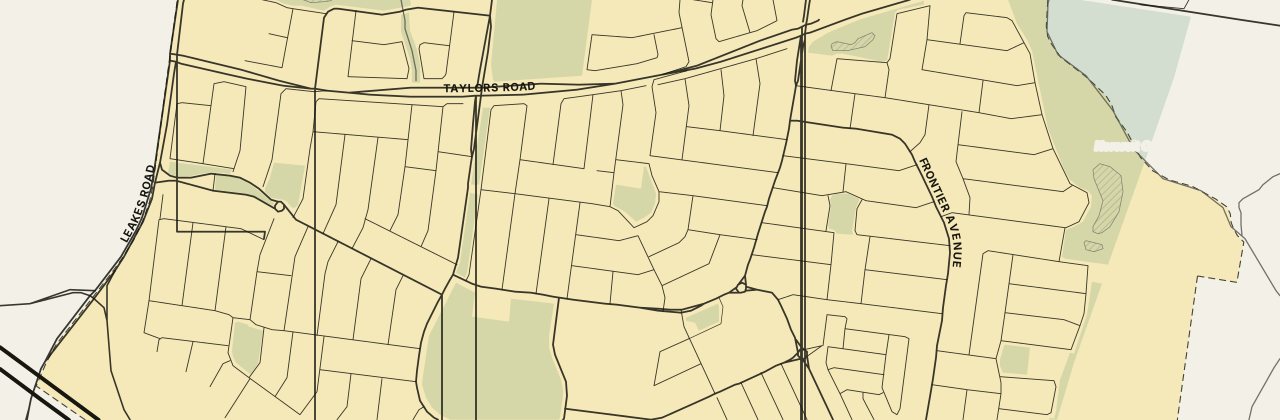
The street map loads here. If it has not appeared, your network blocks the map tiles; every figure on this page stands without it.
Measured in a straight line from Woodlea Town Centre.
Nearby suburbs
All Melbourne suburbs →5 suburbs share a boundary with Aintree, from the ABS suburb boundaries, retrieved 4 November 2026. Letters give the direction from Aintree.
06 Questions about Aintree
What is the nearest train station to Aintree, and how long does it take to get to the city?
The nearest is Rockbank, on the Melton line, a short drive from Woodlea Town Centre. The weekday train gets you to Southern Cross in about 34 minutes.
Which way is Aintree from the Melbourne CBD?
Aintree lies north-west of the CBD. Drivers join the Western Freeway at the Leakes Road on-ramp in Rockbank and head east.
Which schools are in Aintree, and which am I zoned for?
Aintree Primary School, Yarrabing Secondary College and Dharra School all sit in Aintree. For 2027, Aintree North Primary School (interim name) takes just over half the suburb and Aintree Primary School most of the rest. Yarrabing Secondary College takes all of Aintree.
Is there a shopping centre in Aintree?
Yes. Woodlea Town Centre on Lim Way holds a supermarket, a pharmacy and two cafés. Another shopping centre sits in Caroline Springs, a short drive away.
Which council is Aintree in, and which electorates?
Aintree is in the City of Melton. Kororoit is its state electorate and Gorton its federal electorate.
07 Sources
18 sources
- Australian Bureau of Statistics, Australian Statistical Geography Standard Edition 3CC BY 4.0 · retrieved 4 November 2026
- Australian Bureau of Statistics, Counts of Australian BusinessesCC BY 4.0 · retrieved 9 November 2026
- Australian Bureau of Statistics, 2021 Census of Population and HousingCC BY 4.0 · retrieved 4 November 2026
- Australian Bureau of Statistics, Postal Areas 2021 (ASGS Edition 3 allocation file)CC BY 4.0 · retrieved 4 November 2026
- Australian Bureau of Statistics, 2021 Census Working Population ProfileCC BY 4.0 · retrieved 9 November 2026
- Victorian Department of Education, Find My SchoolReference only · retrieved 3 November 2026
- OpenStreetMap contributors; OpenFreeMap tilesODbL · retrieved 15 November 2026
- Public Transport Victoria, GTFS scheduleCC BY 4.0 · retrieved 4 November 2026
- Victorian Department of Education, All Schools FTE Enrolments, February 2026CC BY 4.0 · retrieved 9 November 2026
- Victorian Department of Education, Victorian Government School Zones 2027CC BY 4.0 · retrieved 9 November 2026
- Victorian Department of Education, school locations (DataVic)CC BY 4.0 · retrieved 3 November 2026
- OpenStreetMap contributors via the Overpass APIODbL · retrieved 3 November 2026
- vmbusinessnetwork.com — Culpa Espresso, Coles, Yes Yes Indian Supermarket and othersretrieved 3 November 2026
- woodlea.com.au — Miss Dolceretrieved 3 November 2026
- Overture Maps Foundation, places (release 2026-10-21.0)CDLA Permissive 2.0 · retrieved 3 November 2026
- paulsadlerswimland.com — Paul Sadler Swimland Aintreeretrieved 4 November 2026
- Melton City Council — Timbertop Children's & Community Centreretrieved 4 November 2026
- Vicmap Admin, locality polygons (Department of Transport and Planning)CC BY 4.0 · retrieved 3 November 2026
This page is a guide, not advice. Check zones and timetables with the source before you decide anything. · Map © OpenStreetMap contributors